Bridger Foothills Fire Bozeman MT | Drone Use Grounded
Published: September 13, 2020
Author/Pilot: Dallas Fischer
Category Tags: NEWS
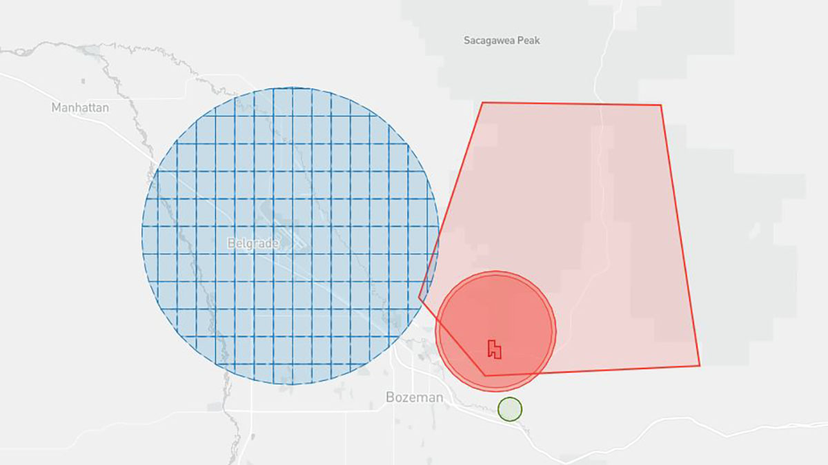
The Bridger Foothills fire moved quickly and grew to over 8200 acres. Weather helped contain the fire and homeowners were able to start returning the next week to inspect the damage. Bozeman based drone pilot, Dallas Fischer, was contacted several times for aerial photographs of the damage, but the area remains closed for drone flights until Nov 14th.
Wildfires instantly put a flight restriction in place for the surrounding area until the fire is contained for a given amount of time. Helicopters and planes are called in to drop fire retardant in certain areas and the fire managers may also be sourcing their own drone services to conduct flights to determine hot spots. Any other drone in the area immediately creates a safety issue and why a flight restriction is put in place.
Montana Drone Company actively helps educate the public about safe drone flights and one of the first things which should always be done is to check a LAANC drone mapping system for the area a drone enthusiast wishes to take off. MDC uses the phone app AirMap as its source to quickly inspect an area for any restrictions. Part 107 pilots and recreational drone enthusiasts can use the AirMap system to apply for instant automated airspace authorizations when flying within 2 to 5 miles of an airport where the max flight elevation changes the closer you get to the airport.
No airspace authorization is available for temporary restrictions like that in place for a wildfire.
Please fly safe and always understand the current conditions of the airspace of where you are located.
AGRICULTURE
BUSINESS VIDEOS
COMMERCIALS
CONSTRUCTION
COOL FLIGHTS
DRONE LAWS
EVENTS
FLIGHT TIPS
INSPECTIONS
INTERVIEWS
MAPPING | SURVEYING
NEWS
NIGHT FLIGHTS
OTHER PROJECTS
POWERSPORTS
PRODUCT VIDEOS
REAL ESTATE COMMERCIAL
REAL ESTATE HOMES
REAL ESTATE LAND
REAL ESTATE RANCHES
TIMELAPSES
UAV MODELS
VIDEO TIPS
WILDLIFE